Yinmin Fm
Type Locality and Naming
Central-north Yunnan (border with southernmost Sichuan). The Yinmin Fm was named by Meng Xianmin (Meng, H. M.), Xu Jie (Hsü, S. C.) et al. in 1944. The reference section is in Sanfengkou-Yinmin, Dongchuan Mine District, Yunnan Province (the original authors didn't designate a naming section). Coordinate: E103º02´00´´; N26º 24´00´´. It is the lower formation of the Dongchuan Gr.
Synonym: (因民组)
Lithology and Thickness
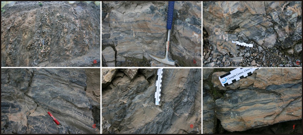
Lower part of the Yinmin Fm is composed of grey-green conglomerate sandwiched with grey-purple dolomitic siltstone (= sugary dolomite?), slate and quartz sandstone. Middle part is purple-red ferruginous slate and muddy dolomite, sandy dolomite accompanied with slate and hematite, with chalcopyrite and bornite. Upper part is purple-red, grey-purple sandy dolomite with minor slate. Oblique bedding, ripple marks and desiccation cracks are mostly seen in the middle and upper parts. It is stable in lithological character. The copper deposit in upper part is one of the main copper deposits in the Dongchuan Copper District. The thickness varies from 225 m to over 388m
Relationships and Distribution
Lower contact
Schematic stratigraphic column shows the underlying unit as the Shiping Complex Gr.
Upper contact
The top is conformably overlain by the Luoxue Fm.
Regional extent
Central-north Yunnan (border with southernmost Sichuan). The formation is mainly distributed around Wuding-Yuanjiang and Dongchuan district.
GeoJSON
Fossils
The uppermost dolomite has microplants: Polygomiomorpha, Matulamorpha, Trachysphaeridium, Pseudozonosphaera etc.
Age
Depositional setting
Additional Information
